



The short answer
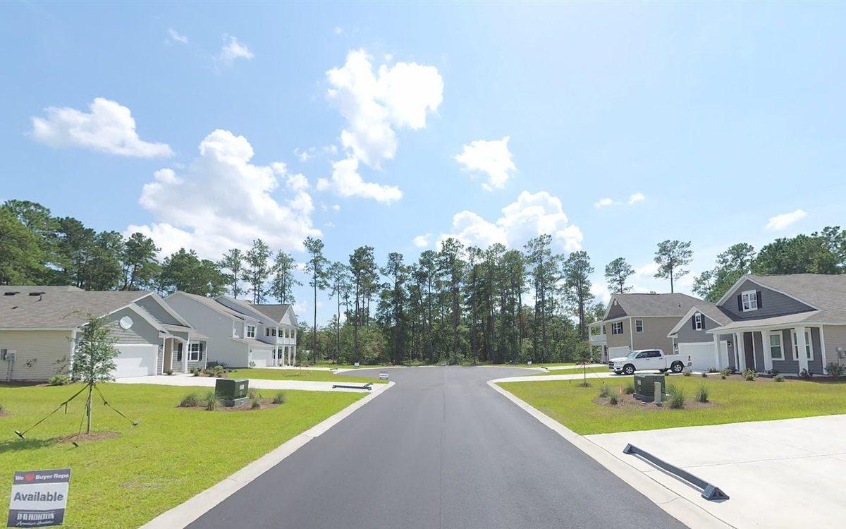
- Street View lets buyers drive a community's streets online before they visit. A new community usually has none, or shows the dirt field it was built on.
- Google's own Street View cars reach new streets on their own schedule, so a new community can go a long time without imagery.
- Bryto captures every street at street level once the roads are paved and publishes it to Google Street View, live in 2 to 10 business days.
- Faces and license plates are blurred, and the job is not closed until you can follow Street View's blue line to the model home's front door.
- Street View is priced per community, from $1,299 with the Portfolio Program or $1,749 without, and every plan puts the streets on the map too.
Why Street View matters for a new community
Buyers and their agents use Street View to see a street before they drive out to it. A new community without imagery shows nothing but the map, or old imagery of the empty land it was built on, which is the opposite of the first impression a builder is paying for.
When to capture
- As soon as the roads are paved, even before the homes are built, so buyers see the layout, the lot views and the entrance.
- Again once the model homes and amenities are in, which is what Community Plus is for.
What Bryto does
- Captures every street at street level, with high-resolution cameras, not drones.
- Blurs faces and license plates and corrects the colors.
- Publishes it to Google Street View, live in 2 to 10 business days.
- Sends a Blue Line Certified link, and does not close the job until you can follow Street View's blue line to the model home's front door.
- Puts the streets on the map as well, because every Street View plan includes Map Mods. See getting a new community onto Google Maps.
What it costs
Community Standard, one capture for a show-ready community, is $1,299 per community with the Portfolio Program and $1,749 without. Community Plus, two captures for a community that changes as it sells, is $1,999 with the program and $2,499 without. Prices and plans are on the Map Mods & Street View page.
Questions builders ask
Why doesn't my new community have Street View?
Google's own cars cover new streets on their own schedule, so new communities often go a long time without imagery, or show the land before it was built on. Imagery captured for the community and published to Google Street View fills that gap.
Can Street View go up before the homes are finished?
Yes. If the roads are paved, capture now: buyers need to see the layout, the lot views and the entrance. Community Plus captures the paved roads now and the model homes and amenities later, any time within 12 months.
Do you use drones?
No. Drone footage is great for marketing videos, but Google can't use it for Street View. Bryto uses high-resolution cameras at street level, which see what a driver sees.
Do I need to be on site for the capture?
No. Bryto handles everything and only needs gate codes or access instructions.
What does Street View for a community cost?
Community Standard, one capture, is $1,299 per community with the Portfolio Program and $1,749 without. Community Plus, two captures, is $1,999 with the program and $2,499 without. Both include getting the community's streets onto the map.
Let buyers walk the streets before they visit
Bryto captures every street of a new community and publishes it to Google Street View, live in 2 to 10 business days.
Rather talk it through? Call (708) 840-1128 or email hello@bryto.com.